
Contents
- 1 Appalachian Trail (USA)
- 2 Pacific Crest Trail (USA)
- 3 Rocky Mountain National Park Trails (USA)
- 4 Mount Washington (USA)
- 5 Banff National Park (Canada)
- 6 John Muir Trail (USA)
- 7 Teton Crest Trail (USA)
- 8 Denali National Park (USA)
- 9 Gros Morne National Park (Canada)
- 10 Kluane National Park (Canada)
- 11 Mount Robson Provincial Park (Canada)
- 12 Great Smoky Mountains National Park (USA)
North America is home to some of the most breathtaking mountain ranges in the world, offering a vast array of hiking trails for every level of adventurer.
From the towering peaks of the Canadian Rockies to the rugged paths of the Sierra Nevada, these trails lead hikers through diverse landscapes, from alpine meadows to dense forests, and provide some of the most stunning panoramic views imaginable.
Whether you’re seeking a challenging summit or a peaceful backcountry escape, North America’s mountain trails have something to offer.
Appalachian Trail (USA)
The Appalachian Trail, often referred to as the AT, is a legendary long-distance hiking trail that winds through the eastern United States, offering an extraordinary journey for hikers and nature enthusiasts. Stretching for over 2,000 miles, the AT traverses a diverse range of geophysical features and provides a rich tapestry of natural wonders and attractions.
Geophysical Traits of the Appalachian Trail
The Appalachian Trail is characterized by a remarkable diversity of geophysical features, making it a playground for those who seek outdoor adventures. Here are some of the key geophysical traits that define the AT:
Mountain Ranges: The AT meanders through some of the most iconic mountain ranges in the eastern United States, including the Appalachian Mountains themselves, the White Mountains in New Hampshire, the Green Mountains in Vermont, and the Great Smoky Mountains along the border of North Carolina and Tennessee. These mountain ranges present a mix of challenges and rewards for hikers, with steep ascents and breathtaking vistas.
Rugged Terrain: Hikers can expect to traverse a variety of terrains, from rocky ridges to root-covered paths, to dense forests. The rugged terrain is a defining characteristic of the AT, offering a sense of adventure and immersion in the wilderness.
Alpine Zones: The AT takes hikers into alpine zones in areas such as the Presidential Range of the White Mountains. Here, above the tree line, they are greeted with sweeping panoramic views and challenging conditions that can range from sunny and serene to cold and blustery.
Scenic Overlooks: The AT is renowned for its stunning vistas and numerous scenic overlooks. Hikers can pause along the trail to admire the beauty of valleys, rivers, and distant peaks. Notable viewpoints include McAfee Knob in Virginia, Clingmans Dome in the Great Smoky Mountains, and Mount Washington in New Hampshire.
Water Crossings: The AT features numerous river and stream crossings, from small, babbling brooks to more significant waterways. Hikers may find both footbridges and the need to ford streams, adding a dynamic element to their journey.
Gaps and Passes: The trail often passes through low-elevation gaps or notches between mountain ranges. These points on the AT may provide a respite for hikers and offer picturesque settings for rest stops.
Pacific Crest Trail (USA)
The Pacific Crest Trail, commonly known as the PCT, is a jewel in the crown of long-distance hiking trails. Spanning approximately 2,650 miles from the border of Mexico to the border of Canada, this trail offers a spectacular journey through diverse geophysical features and an array of attractions for hikers.
Geophysical Traits
The Pacific Crest Trail showcases an astonishing variety of geophysical traits, making it a playground for outdoor enthusiasts. Here are some key geophysical features that define the PCT:
Mountain Ranges: The PCT traverses some of the most breathtaking mountain ranges in the western United States, including the Sierra Nevada in California, the Cascades in Oregon and Washington, and the desert ranges of Southern California. Hikers can expect dramatic elevation changes and ever-changing vistas.
Alpine Zones: Hikers on the PCT have the privilege of experiencing alpine environments with high mountain passes, snowfields, and above-the-timberline landscapes. The John Muir Trail, a portion of the PCT, leads through the heart of the Sierra Nevada, where alpine meadows and pristine lakes await.
Desert Stretches: The Southern California portion of the PCT offers a contrasting experience with desert terrain, including the iconic Mojave Desert. Hikers will encounter cacti, Joshua trees, and expansive vistas.
Forested Sections: As the trail moves north, it enters lush, forested regions where tall pine trees provide shade and fragrant alpine air fills the lungs. The forests of Oregon and Washington are especially known for their beauty.
Volcanic Landscapes: The PCT passes through areas with recent volcanic activity, such as the Three Sisters and Mount Shasta in Oregon and California, respectively. These regions feature rugged volcanic terrain and unique geological formations.
Lakes and Rivers: Hikers along the PCT are treated to a multitude of serene lakes and fast-flowing rivers. These water bodies offer excellent opportunities for fishing, swimming, and camping beside clear mountain waters.
Scenic Overlooks: The trail is replete with awe-inspiring viewpoints, including the jagged peaks of the North Cascades and the stunning vistas from places like Forester Pass in the Sierra Nevada and Mount Hood in Oregon.
High Mountain Passes: The PCT is renowned for its high mountain passes, such as Forester Pass, Mather Pass, and Pinchot Pass in the Sierra Nevada. These passes challenge hikers with their elevation and often offer extraordinary views.
Rocky Mountain National Park Trails (USA)
Nestled in the heart of the Rocky Mountains, Rocky Mountain National Park (RMNP) offers hikers a treasure trove of breathtaking trails and awe-inspiring landscapes. This iconic national park, located in Colorado, boasts a rich variety of geophysical traits and a multitude of attractions for hikers.
Geophysical Traits
The Rocky Mountain National Park trails showcase a stunning array of geophysical features, which make it a hiker’s paradise. Here are some key geophysical traits that define the park’s trails:
Majestic Mountain Ranges: RMNP is nestled within the Front Range of the Rocky Mountains, offering hikers access to towering peaks and rugged mountain ranges. The park is home to 77 mountain peaks over 12,000 feet, including Longs Peak, which stands at 14,259 feet and is the highest point in the park.
Alpine Zones: Hikers can venture into alpine environments, where they’ll find themselves above the tree line. These high-altitude zones are home to delicate alpine flora, stunning vistas, and unique challenges such as rapidly changing weather conditions.
Glistening Glacial Lakes: RMNP is renowned for its pristine, glacially-carved lakes that shimmer in various shades of blue and green. Popular examples include Bear Lake, Dream Lake, and the iconic Emerald Lake. These serene bodies of water provide excellent picnic spots and photographic opportunities.
Rugged Terrain: The park’s trails take hikers across a variety of terrains, from well-maintained paths to more challenging, rocky and steep sections. This rugged terrain adds to the sense of adventure and exploration.
Subalpine Forests: Dense forests of pine, fir, and spruce trees are a prominent feature of RMNP. Hikers can enjoy shade from these subalpine forests while wandering through scenic woods teeming with wildlife.
Wildflower Meadows: During the summer months, wildflower meadows burst into vibrant displays of color, with flowers such as columbines, Indian paintbrush, and asters carpeting the landscape.
Glaciers and Glacial Valleys: The park features remnants of glaciers and spectacular glacial valleys, most notably in the Mummy Range and the aptly named Glacier Gorge.
Mount Washington (USA)
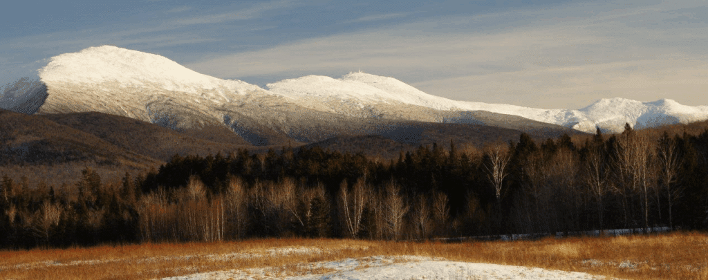
Mount Washington, standing as the highest peak in the Northeastern United States, is a crown jewel of the White Mountains in New Hampshire. It’s a place of rugged beauty and formidable geophysical traits, drawing hikers and adventurers from near and far. We’ll explore the geophysical wonders and attractions that make Mount Washington a legendary destination for hikers.
Geophysical Traits
Mount Washington is defined by a variety of geophysical features that captivate the senses and challenge hikers. Here are some key traits that set this mountain apart:
High Altitude: At an elevation of 6,288 feet (1,917 meters), Mount Washington towers above the surrounding landscape, offering a dramatic change in altitude and climate.
Unpredictable Weather: Mount Washington is notorious for its ever-changing weather conditions. It’s home to some of the most extreme weather in the world, with rapid shifts from clear skies to fog, snow, and hurricane-force winds.
Alpine Zone: As hikers ascend, they pass through the alpine zone, a treeless environment characterized by low-lying vegetation and unique flora adapted to harsh conditions.
Tuckerman and Huntington Ravines: These are two iconic glacial cirques on the mountain, known for their steep slopes and challenging terrain, attracting experienced hikers and backcountry skiers.
Auto Road and Cog Railway: For those seeking an alternative to hiking, the Mount Washington Auto Road and the Cog Railway offer thrilling ways to reach the summit. These historic modes of transport provide stunning vistas along the way.
Glacial Cirques: These glacial features are characterized by their steep, bowl-shaped terrain, and they offer both challenging ascents and breathtaking views. Tuckerman Ravine and Huntington Ravine are two notable examples.
Unique Rock Formations: Mount Washington is known for its granite rock formations, including the distinctive “Bigelow Lawn,” which provides a platform for hikers to rest and take in views of the Great Gulf and Presidential Range.
Banff National Park (Canada)
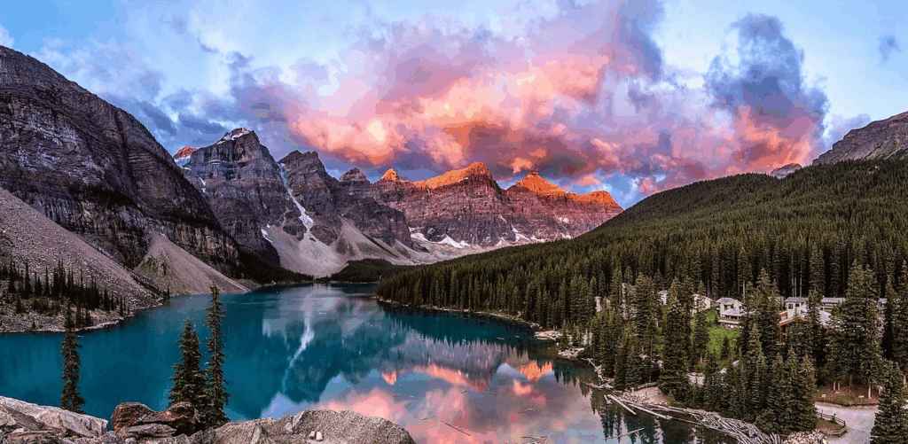
Nestled in the heart of the Canadian Rockies, Banff National Park is a haven for outdoor enthusiasts, a land of geophysical wonders, and a treasure trove of attractions for hikers.
Geophysical Traits
Banff National Park is a rugged and diverse landscape, offering an array of geophysical features that make it a haven for hikers. Here are some key geophysical traits that define the park’s trails:
Majestic Mountain Peaks: The park is home to stunning mountain ranges, including the Canadian Rockies, with peaks such as Mount Rundle, Mount Temple, and Cascade Mountain. These soaring peaks provide a dramatic backdrop to the hiking trails.
Glacial Lakes: Banff National Park boasts a plethora of glacially-fed lakes, each with its unique charm. Lake Louise, Moraine Lake, and Bow Lake are known for their vibrant turquoise waters and stunning mountain reflections.
Glaciers: Glaciers are integral to the park’s geology, with Columbia Icefield being one of the most prominent. Hikers can access some of the park’s glaciers, experiencing their colossal presence.
Wildflower Meadows: During the summer months, alpine meadows burst into bloom with colorful wildflowers like fireweed, Indian paintbrush, and alpine avens.
Glistening Waterfalls: Trails in Banff lead to breathtaking waterfalls, including Johnston Canyon, Sunwapta Falls, and Athabasca Falls, where the power of water has carved impressive canyons.
Cave Systems: The Burgess Shale in Yoho National Park (adjacent to Banff) is a UNESCO World Heritage Site known for its exceptional preservation of fossils, including some of the earliest known animals.
Hot Springs: Banff Upper Hot Springs offers a unique experience, allowing hikers to relax in the warm, mineral-rich waters with mountain vistas.
Canyons: The park features deep canyons carved by rivers, such as Maligne Canyon and Johnston Canyon, offering fantastic hiking experiences.
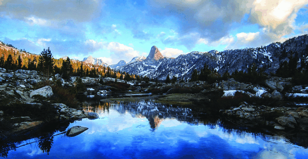
John Muir Trail (USA)
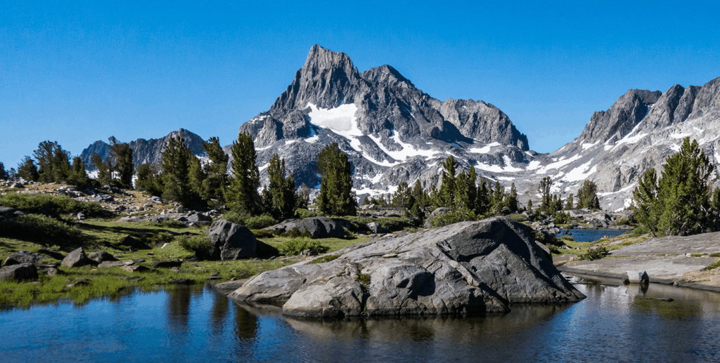
Stretching for over 200 miles through the heart of the Sierra Nevada mountain range in California, the John Muir Trail (JMT) is a true testament to nature’s grandeur.
Named after renowned naturalist and preservationist John Muir, this trail winds its way through some of the most stunning geophysical features and offers an array of attractions for hikers.
Geophysical Traits
The John Muir Trail is defined by its breathtaking geophysical features, showcasing the unique beauty of the Sierra Nevada:
High Mountain Peaks: The trail traverses through some of the Sierra Nevada’s tallest peaks, including Mount Whitney, which stands as the highest point in the contiguous United States at 14,505 feet (4,421 meters).
Alpine Lakes: Hikers will encounter pristine alpine lakes, such as Thousand Island Lake and Evolution Lake, offering stunning reflections of the surrounding mountains.
Giant Sequoias: The trail takes you through groves of giant sequoias, including the famed Lyell Tree, a tribute to the colossal trees that inhabit the Sierra Nevada.
Mountain Passes: Hikers will cross over a series of high mountain passes, such as Forester Pass and Muir Pass, each offering breathtaking views and a sense of accomplishment.
Deep Canyons: The trail descends into deep canyons like Le Conte Canyon and Kings Canyon, revealing the geologic history of the region.
Wildflower Meadows: During the summer months, the meadows along the JMT burst into bloom, with wildflowers like lupine and Indian paintbrush painting the landscape with vibrant colors.
Crystal Clear Streams: The trail meanders alongside pristine mountain streams, providing refreshing drinking water and peaceful spots for rest.
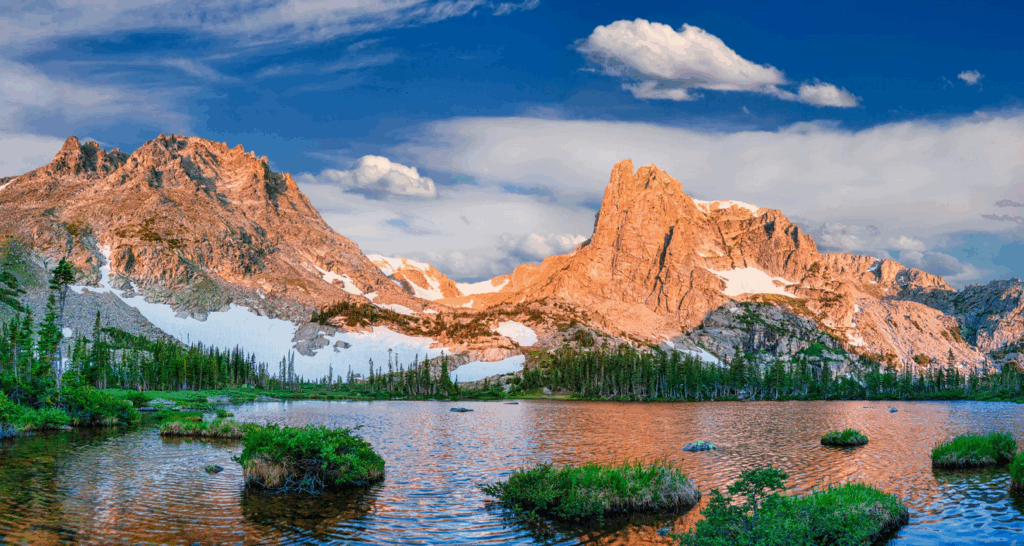
Teton Crest Trail (USA)
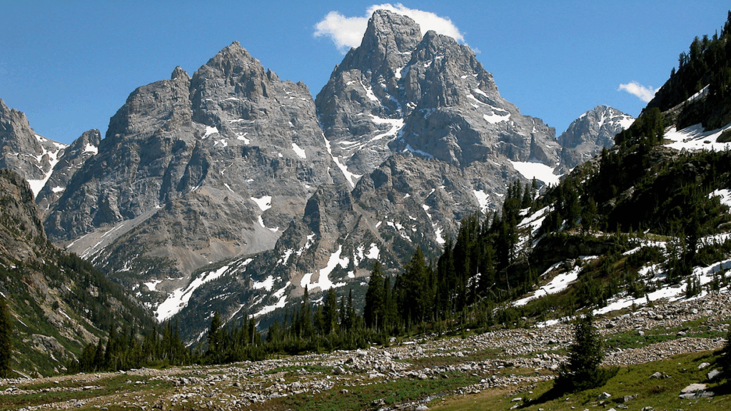
Nestled in the heart of the dramatic Teton Range of Wyoming, the Teton Crest Trail is a 40-mile-long masterpiece of nature’s grandeur.
This trail showcases a remarkable range of geophysical traits and offers a plethora of attractions for hikers.
Geophysical Traits
The Teton Crest Trail, winding through Grand Teton National Park and the Jedediah Smith Wilderness, is characterized by a stunning array of geophysical features that define its beauty:
Grand Teton Mountains: The trail offers an uninterrupted view of the Grand Teton, which towers over 13,770 feet (4,198 meters) above sea level, creating a dramatic backdrop.
Alpine Lakes: Hikers will come across pristine alpine lakes like Marion Lake, Sunset Lake, and Phelps Lake, each offering a serene setting surrounded by rugged mountain peaks.
Wildflower Meadows: During the summer, the trail transforms into a wildflower wonderland, with meadows bursting with vibrant colors, including lupine, Indian paintbrush, and more.
Mountain Passes: Hikers will ascend and descend over a series of high mountain passes, such as Hurricane Pass and Paintbrush Divide, providing awe-inspiring panoramic views.
Glacial Valleys: The trail takes you through glacial valleys like Cascade Canyon, carved by ancient glaciers and now home to flowing streams and lush vegetation.
Rugged Terrain: The trail leads hikers through rocky slopes, dense forests, and open meadows, offering varied geophysical terrain to explore.
Lush Forests: Parts of the trail pass through dense pine and fir forests, providing cool shade and pleasant hiking conditions.
Cascading Waterfalls: Hikers can enjoy the sights and sounds of cascading waterfalls along the trail, including Hidden Falls in Cascade Canyon.
Denali National Park (USA)
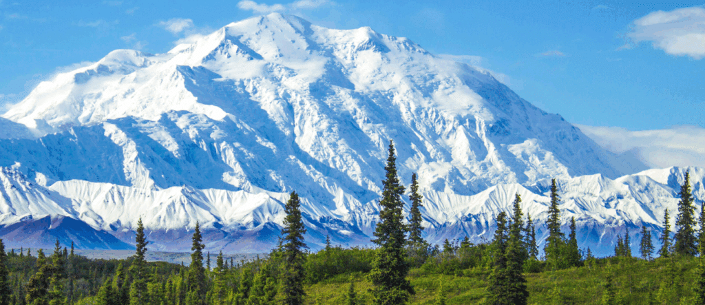
Nestled in the heart of Alaska’s wild expanse, Denali National Park boasts a network of trails that offer an opportunity to immerse yourself in some of the most breathtaking and pristine geophysical traits of North America.
From its rugged mountains to its expansive tundra, this park is a paradise for hikers and outdoor enthusiasts.
Geophysical Traits
Denali National Park’s trails traverse a remarkable landscape that includes the following geophysical features:
Mount Denali: The park is anchored by the towering presence of Mount Denali, formerly known as Mount McKinley. At 20,310 feet (6,194 meters), it dominates the region, creating a breathtaking backdrop for hikers.
Alaska Range: The trails lead hikers through the stunning Alaska Range, which encompasses numerous rugged mountains, each with its unique character.
Glacial Rivers: The park’s rivers, such as the Savage River and Teklanika River, are braided and glacier-fed, providing opportunities for refreshing dips and picturesque vistas.
Alpine Tundra: Hikers will explore the vast alpine tundra, known for its colorful wildflowers in summer, offering a vibrant contrast to the rugged peaks.
Braided Rivers: The park’s braided rivers are a natural wonder, meandering through wide valleys, revealing the stark beauty of the landscape.
Gros Morne National Park (Canada)
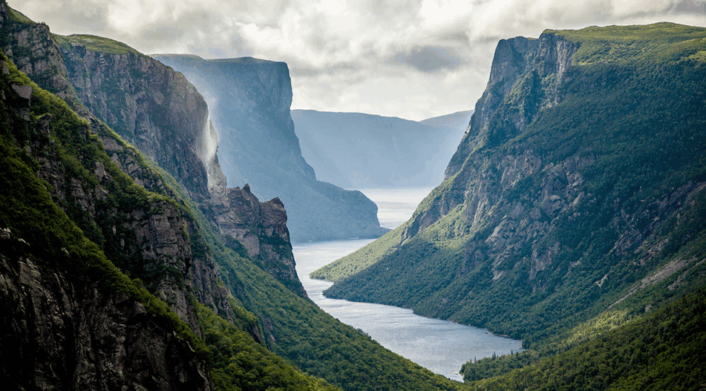
Located on the western coast of Newfoundland, Canada, Gros Morne National Park is a UNESCO World Heritage Site and a geological wonderland.
Its trails offer an opportunity to delve into some of the most stunning geophysical features of the planet while immersing yourself in the remarkable natural beauty of Newfoundland.
Geophysical Traits
Gros Morne National Park’s trails lead hikers through a captivating landscape shaped by geological wonders, showcasing remarkable features:
The Tablelands: The most iconic feature of the park, this area resembles a barren Martian landscape with rust-colored, peridotite rock, a glimpse into the Earth’s mantle.
Long Range Mountains: Hikers explore the Long Range Mountains, which include towering cliffs, fjords, and dramatic coastlines along the Gulf of St. Lawrence.
Glacial Valleys: The park’s glacial valleys, like Western Brook Pond, showcase pristine, deep, and crystal-clear fjords with waterfalls and dramatic cliffs.
Karst Topography: Gros Morne is home to impressive limestone formations, such as sinkholes and underground caves, created by the dissolving action of water over thousands of years.
Pristine Lakes: Serene and sparkling freshwater lakes, like Western Brook Pond and Green Gardens, add to the park’s natural allure.
Kluane National Park (Canada)
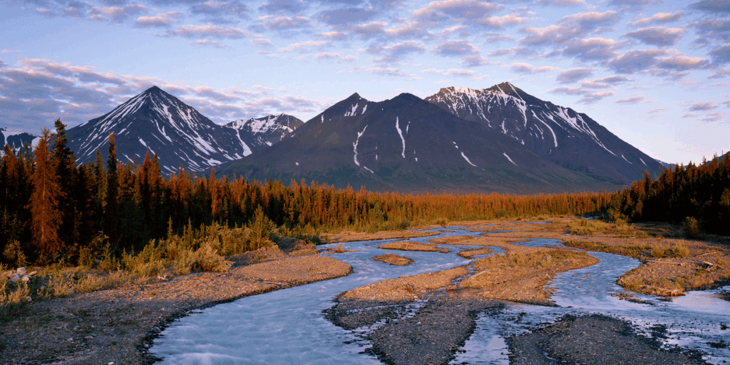
Nestled in the Yukon Territory of Canada, Kluane National Park and Reserve is a remote wilderness that beckons hikers and outdoor enthusiasts with its awe-inspiring geophysical traits and natural wonders.
The park, part of a UNESCO World Heritage Site, boasts an array of trails that provide a journey into the heart of this unspoiled landscape.
Geophysical Traits
Kluane National Park’s trails traverse a pristine wilderness defined by dramatic geophysical features:
Mount Logan: The park is home to Mount Logan, Canada’s highest peak, which towers at a staggering 19,551 feet (5,959 meters), providing a majestic backdrop to the landscape.
Kluane Ranges: Hikers explore the Kluane Ranges, a rugged mountain range featuring majestic peaks, icefields, and glaciers.
Giant Glaciers: The park encompasses colossal glaciers, including the Lowell Glacier and the Kaskawulsh Glacier, which flow through the rugged terrain.
Crystal-Clear Lakes: Trails take hikers to pristine alpine lakes, such as Grizzly Lake, nestled in the heart of the park’s stunning wilderness.
Subarctic Tundra: The park’s lowlands are blanketed in subarctic tundra, which bursts into vibrant wildflower blooms during the summer months.
Alpine Plateaus: Hikers ascend to high alpine plateaus, including King’s Throne, which offer breathtaking vistas of the rugged surroundings.
Mount Robson Provincial Park (Canada)
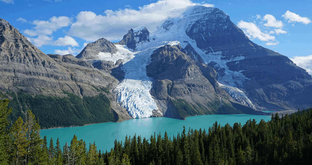
Nestled within the awe-inspiring Canadian Rockies of British Columbia, Mount Robson Provincial Park beckons hikers and nature enthusiasts with its stunning geophysical traits and natural splendor.
Home to the iconic Mount Robson, the highest peak in the Canadian Rockies, this park offers a network of trails that provide a captivating journey into the heart of the region’s untamed wilderness.
Geophysical Traits
Mount Robson Provincial Park’s trails traverse a pristine landscape marked by remarkable geophysical features:
Mount Robson: The park’s namesake and focal point, Mount Robson, soars to an impressive 12,972 feet (3,954 meters) and is the highest peak in the Canadian Rockies. Its striking presence dominates the surrounding landscape.
Berg Lake: The iconic Berg Lake, nestled at the base of Mount Robson, is an azure gem surrounded by glaciers, waterfalls, and rugged mountain peaks.
Robson Glacier: Trails offer glimpses of the Robson Glacier, one of the few glaciers in North America accessible to hikers.
Alpine Meadows: Hikers ascend to high alpine meadows, including Mumm Basin, adorned with wildflowers in the summer and panoramic views of the surrounding peaks.
Glacial Rivers: Trails wind alongside pristine glacial rivers, providing both serene scenery and opportunities for a refreshing dip.
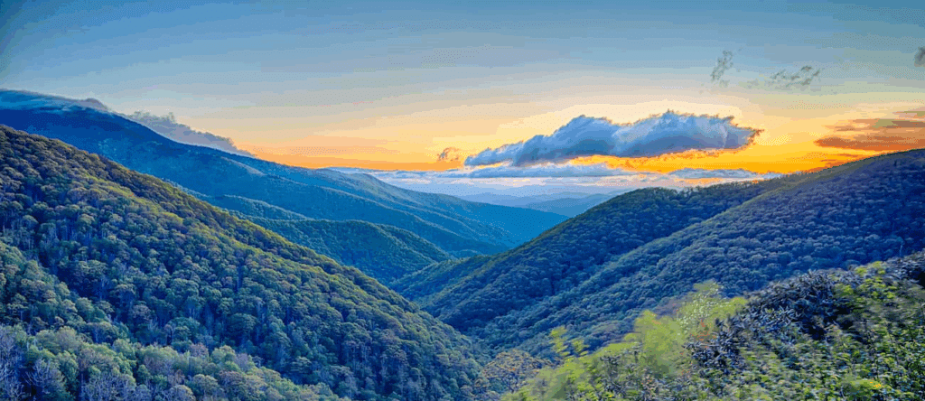
Great Smoky Mountains National Park (USA)
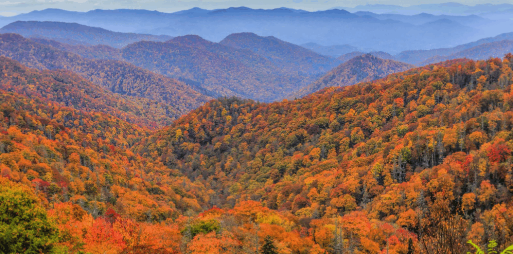
Nestled on the border of North Carolina and Tennessee, the Great Smoky Mountains National Park is a hiker’s paradise, offering a rich tapestry of geophysical traits and breathtaking natural beauty.
As the most visited national park in the United States, the Smokies boast an extensive network of trails that invite adventurers to explore their wonders.
Geophysical Traits
The park’s trails traverse a diverse and stunning landscape, showcasing geophysical features that captivate the imagination:
Great Smoky Mountains: The park is named after these ancient, mist-covered mountains, which are part of the Appalachian Range. The range boasts an abundance of plant and animal species.
Diverse Forests: Hikers traverse lush, temperate rainforests filled with old-growth hardwoods, such as oak, hickory, and maple, along with conifers like fir and spruce.
Wildflower Blooms: During spring and summer, the Smokies explode with vibrant wildflower displays, with iconic species like flame azalea and mountain laurel.
Misty Valleys: The park is famous for its frequent fog and mist, creating an ethereal atmosphere in the valleys, with Cades Cove being a prime example.
Waterfalls: Hikers encounter numerous waterfalls, such as Laurel Falls and Abrams Falls, adding to the park’s allure.
Rippling Streams: The park features pristine mountain streams like the Little River, which meander through the lush forests, offering opportunities for relaxation.